Since finishing my private pilot certificate, flying hours have been few and far between. That’s mainly due to the fact that I’m trying to pay off that flight school debt, and at $125 an hour flight hours aren’t helping that goal. Even so I need to keep my skills up, so I scheduled a flight a couple days ago to go fly around north of San Antonio. The plan was to head to Gillespie County Airport (T82) in Fredericksburg for some lunch (via full stop landing at New Braunfels, so I can log some cross country time), test out the Nexus 9 and Garmin Pilot on the way, and then head back in time for work that night. Things didn’t go as smoothly as I had hoped . . .
The day started off perfectly. I arrived at the airfield to pick up my rented airplane slightly early, so I had plenty of time to pre-flight and get ready to go. I noticed during the walk around that the fuel indicator for the right tank was showing only half full, so I taxied over to the gas pumps and topped off the tank before taking off.
The first two legs of the flight were quiet and uneventful. As I had hoped, scheduling my flight for early Friday afternoon had meant that I was more or less on my own in the air north of San Antonio, and even the commercial jets flying in and out of San Antonio International seemed few and far between.
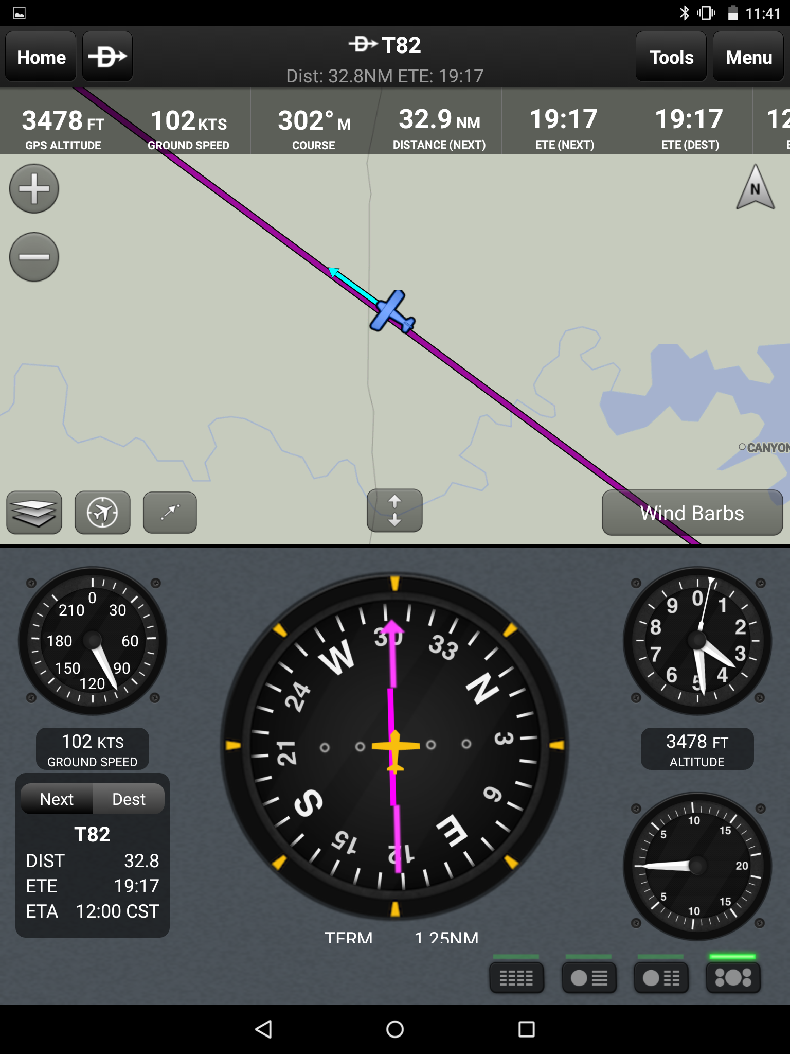
As I left New Braunfels’ airspace I flipped back to San Antonio Approach and asked for flight following for my flight towards Fredericksburg. The destination airport itself was well outside San Antonio’s radar coverage, but the majority of my flight was right past the Class C airspace around the city and I was counting on the approach controllers to help keep me from crashing into anyone else who might be out flying. They assigned me a squawk code, and then for the next 20 minutes I heard almost no traffic. I had a brilliant view of Canyon Lake, but besides that one landmark there isn’t much north of San Antonio to look at.
About 15 miles out from Fredericksburg the approach controllers let me know that I would be leaving their coverage soon, and asked if I wanted to be passed to the Center controllers to continue the flight following service. I declined, since I would need to switch to the CTAF for Fredericksburg before long and I didn’t want to bother the busy Center for the five minutes in which their services would be useful to my flight. And anyway, how busy could Fredericksburg possibly be on a Friday afternoon?
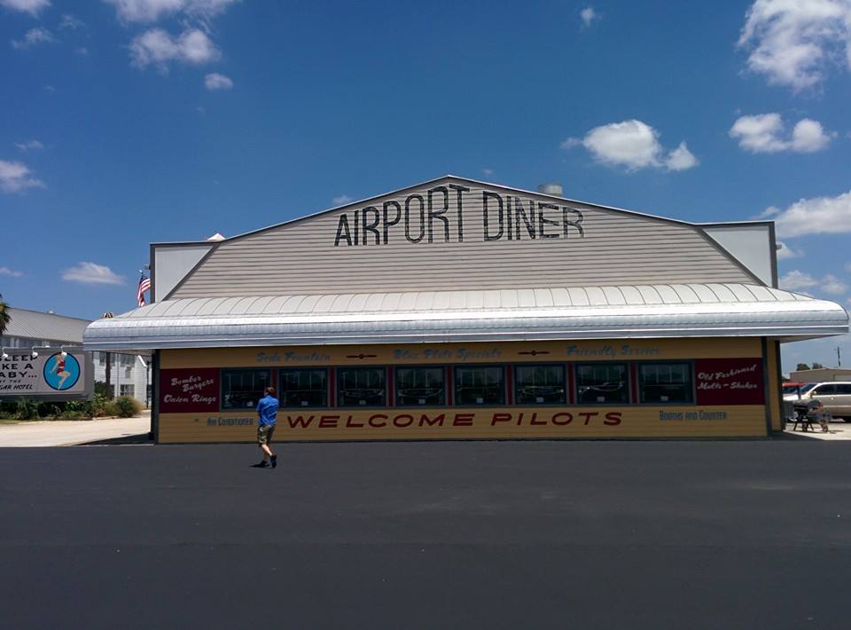
Gillespie County Airport is a popular stop for pilots and small airplanes in the area. The main attraction is an on-airport aviation themed hotel and dance hall, with a rather delicious diner facing the transient parking area of the apron and just yards from the tie-downs. I had been to this airport with a friend before I started my flight training just to much on a burger and watch the planes fly by, and ever since it has been my go-to destination for cross country flights and local flying.
METAR KT82 161755Z AUTO 25003KT 10SM CLR 13/03 A3032 RMK AO2 T01250026 10125 21025
As I set my transponder to 1200 and tuned into the Gillespie County CTAF that afternoon, I was about 10 miles southeast of the airport with clear blue skies. San Antonio Approach hadn’t indicated any traffic of immediate concern for me, but there was a good bit of chatter on the radio. Gillespie County shares a CTAF frequency with Kerrville (KERV), a two-runway airport only a couple miles south that also gets a good bit of traffic. As I listened, I tried to note where everyone was. One Piper was departing Kerrville southbound, no concern to me — already south of my position. Another Cessna was on short final for Fredericksburg, so they should be out of the air shortly and similarly not an issue. A Piper Cub reported in just before I was able to key the mic about 1 mile further away due east of the field, on the same side as the field as I was but further and slower — I figured I should be able to clear the runway before they were on short final.
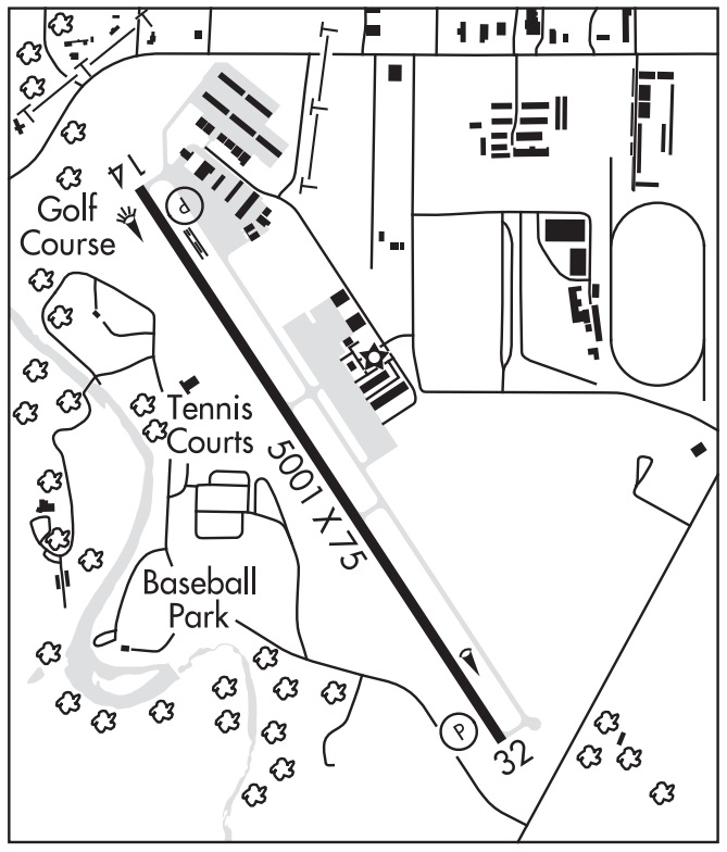
I announced my position and intentions. “Gillespie county, Cessna 901, 9 miles southeast of the field, I will be crossing over the field and entering right downwind for 14, Gillespie County.” The airport has a single runway, and with the proximity to downtown Fredericksburg the airport has a note in the Airport Facility Directory that runway 14 is preferred and should operate with a right pattern. That right pattern not only keeps the noisy airplane traffic away from people’s homes, but also makes for a great show for the people at the airport hotel watching from their rocking chairs.
Field elevation for Fredericksburg is about 1,700 feet MSL, which places the traffic pattern altitude at approximately 2,700 feet. Since T82 is a non-towered airport, it was entirely possible that there might be a couple airplanes operating without radios and I wanted to be extra cautious that I didn’t run into anything in the air. My plan was to continue at my current altitude — 3,500 feet — and pass directly over the center of the airport. That should keep me well above any traffic in the pattern, give me a good look at any other traffic floating around, and when I was happy that I knew where everyone was I could turn around and make a standard 45 degree entry to the right downwind for runway 14.
When I was only about four miles from the airport another aircraft made its first call. “Gillespie County, Archer 123 five miles south of the airfield, we will be passing the field on the right downwind for 14.”
Until this point, I thought that I was going to be pretty much alone over the field until the Piper Cub caught up. I tried to parse the call and figure out how this new player fit into the puzzle, and I thought I would still be A-OK. He had indicated that he would be passing through the pattern at Fredericksburg in the “right downwind” for the airport, but he hadn’t stated an altitude. In my mind, the term “right downwind” indicates a very specific location — altitude included — that was well below my intended flight path. Just to be sure everyone knew the score I again announced my position and intentions on the CTAF, and again the Piper Cub reported himself even further behind me.
As I started crossing the airport, I was scanning for the Archer. I expected him to show up low and to my left, crossing left to right underneath me about 700 to 1,000 feet below. Instead the first time I saw him was when he was straight in front of me. About 500 yards straight in front of my nose, level with me at 3,500 feet, the Archer crossed directly in front of me from left to right and continued on their way.
I continued as planned, flipping a 180 a little ways off from the airport, entering the right downwind for 14, and landing without a problem. I taxied to the diner, tied the plane down, and went inside to have some lunch and think about what just happened.
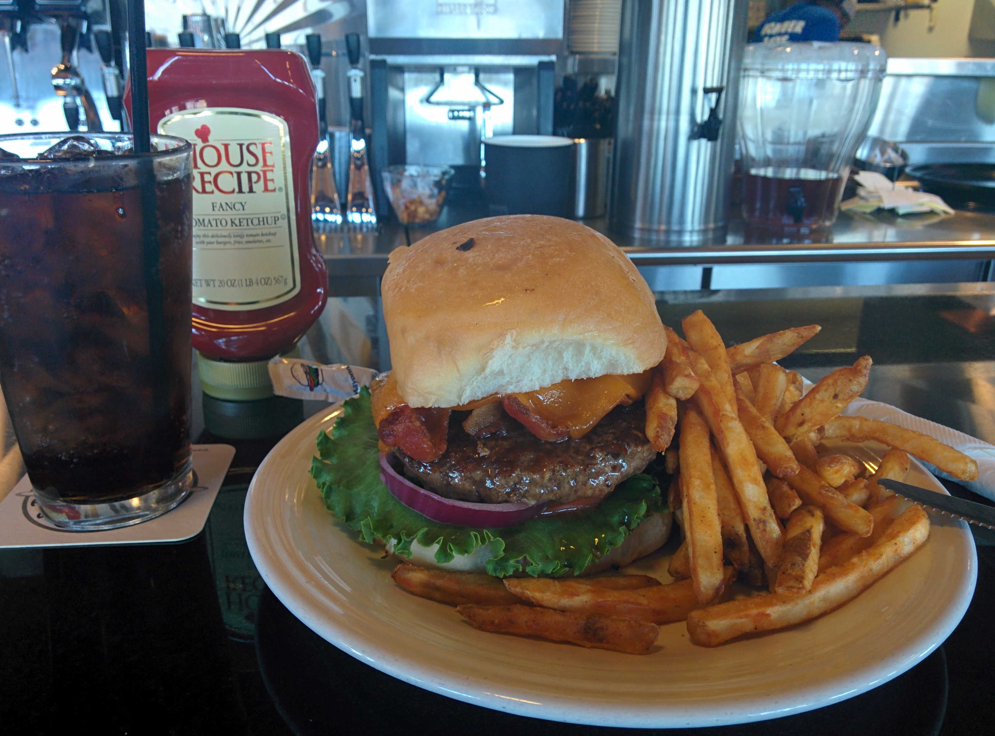
What really concerned me was that I was less than a minute from a “near miss.” The FAA considers any incident where two airplanes come closer than 500 feet a “loss of separation,” and while I was still 100% legal I sure as heck didn’t feel 100% safe. I had missed an airplane, and if I had been a minute or so sooner there was a possibility that we might have collided. That very much concerned me as I munched on my cheeseburger.
There are definitely some things that went wrong, and possibly some things I could have done better.
The root cause of this near near miss was an assumption. I had assumed not only a location but an altitude from the Archer pilot’s announcement that he would be flying the “right downwind” at the airport. In my mind that radio call meant that he would be transiting through the pattern at pattern altitude, not the 3,500 foot altitude that I was using in an attempt to avoid that whole mess.
Compounding this issue was the fact that I didn’t announce my altitude either. I simply announced that I would be “flying over” the airfield, not at any specific altitude. Since he didn’t know my altitude, and I didn’t know his altitude, we both made assumptions that the other pilot was somewhere above or below us. The end result was a possible coming together of our airplanes, which was not cool.
After I finished lunch, I decided to skip the return flight to New Braunfels and simply head back home — a 15 minute flight instead of 45 minutes. On my way back into the pattern at the home base, I decided to start adding something to my initial radio calls: an altitude. If the other pilots won’t tell me where they are, at the very least I can tell them where I am.
I like towered airports. Controlled chaos is better that uncontrolled chaos. But uncontrolled airfields are a fact of life, and something I need to work on.
Things I learned:
- Don’t assume altitude. Ever.
- Announce altitude when over-flying an uncontrolled airfield.
- Keep your eyes outside, and keep scanning. Not everyone is where they say they are.
I enjoyed reading over your site. I am also local to San Antonio. It’s been 8 years since I used my PPL. I am making efforts to get back into flying, until them I will live viciously through your posts. Keep them coming.
Clint.
*vicariously
HA!! Wow, that’s a funny slip… err stupid auto-correct. Thanks for the help Tom.
I’ve been flying since ’95, and hold more ratings than I can keep current. A couple of years ago I was doing some recurrent training wit a CFI who said “you can tell the professionals because they always report altitude.”
I realized that on IFR, altitude is part of checking in, and it becomes so engrained that the pilots do it by instinct even on VFR.
And with that, I too changed my VFR calls.