Garmin Pilot is the only real option for a full featured navigation suite on the Android platform, but it looks like they aren’t resting on their laurels. In the last major update they added train and obstacle identification into their database, and while 5.0 doesn’t have many big new features it does sport a brand new user interface. Gone are the huge buttons on the screen, replaced with a more Android-esque hamburger menu and other nice UI improvements that do make it easier to navigate around the app while in the air.
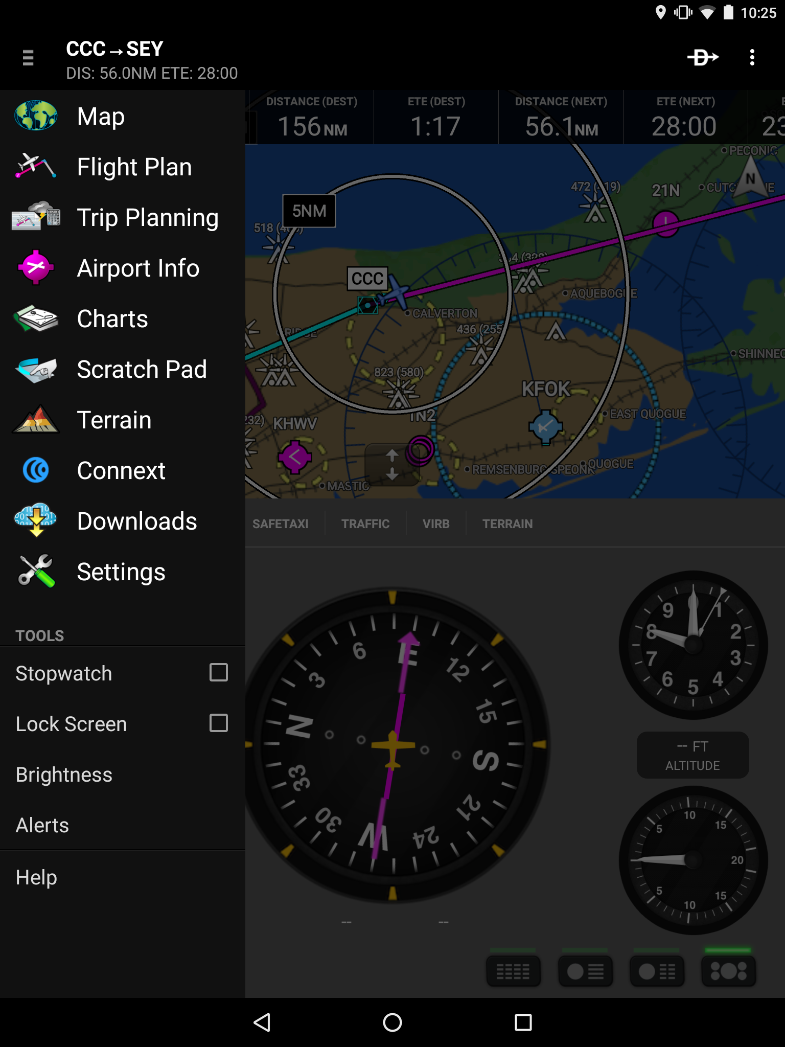
Like I said, the biggest change is the look and feel. Previously, it seemed like the app designers were trying to stick as close to the look and feel of the GTN avionics displays as possible to create a common look and feel across the entire line of products. This is definitely a departure from that line of thinking, and so far I’m a fan. It makes much better use of the screen space than the previous configuration and improves the look and feel of the app tremendously.
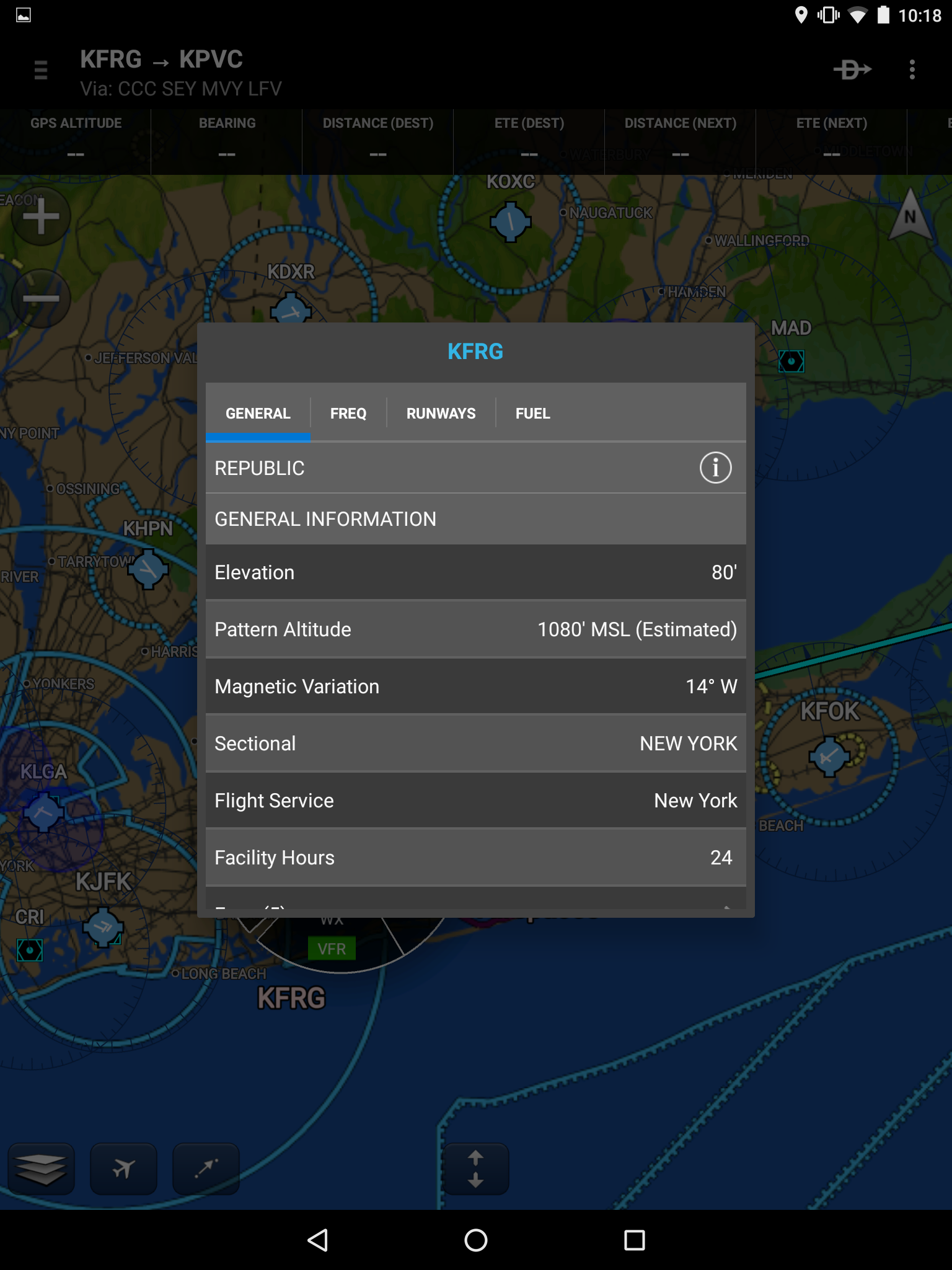
The information menu for airports on the main map page has changed as well. Previously, in order to get to the more detailed “Airport” page in the app you needed to tap the airport, select the airport from the ring menu, scroll to the bottom of the information box, and then press “More Information.” It was a bit annoying in the air, and thankfully the Garmin Pilot folks have fixed that workflow. Tap the airport, tap the airport symbol, and then tap the (i) icon for the full Airport page.
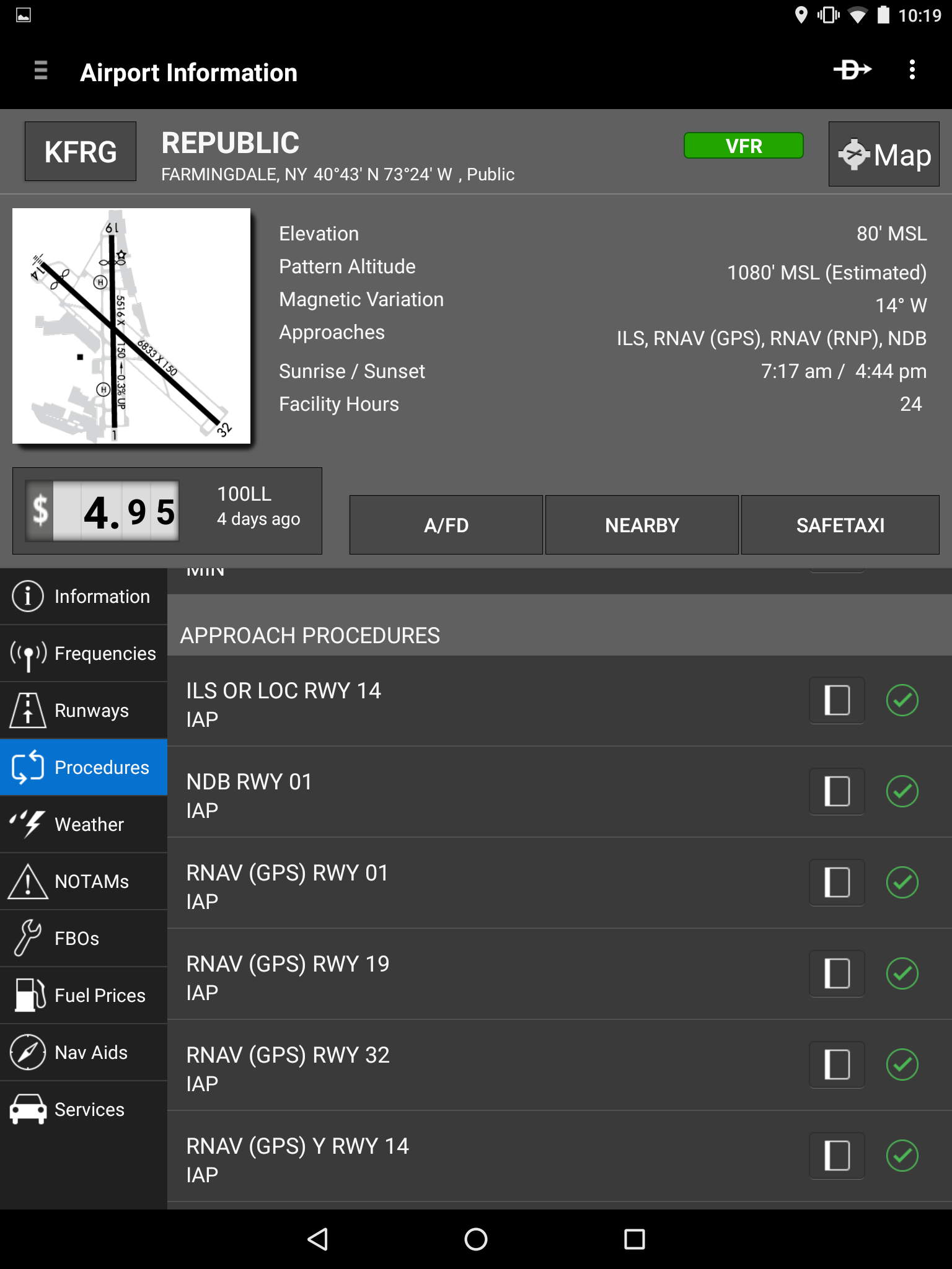
While the look and feel of the Airport page has changed the information and general logic of the page remains the same.
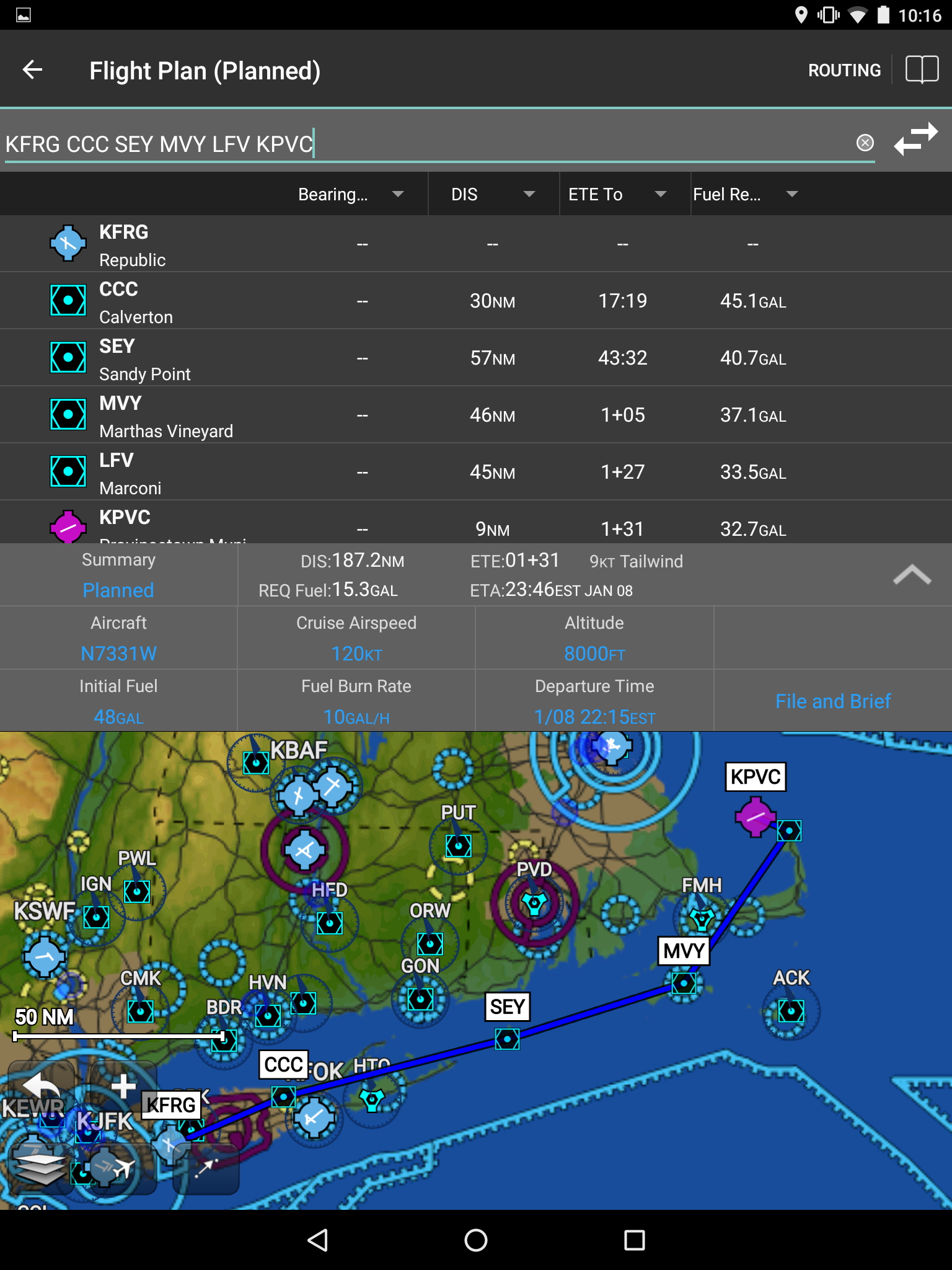
Over on the flight planning page things are changing for the better. Instead of simply displaying the route, the page now displays helpful things like estimated time enroute and fuel burn calculated with current weather conditions. This was previously only possible through the “Flight Planning” page, but now you can sit and tinker with your flight plan to your heart’s content without needing to go through the slightly longer process of creating a full flight plan. Another nice thing: you can file your plan right from this page if you’re happy.
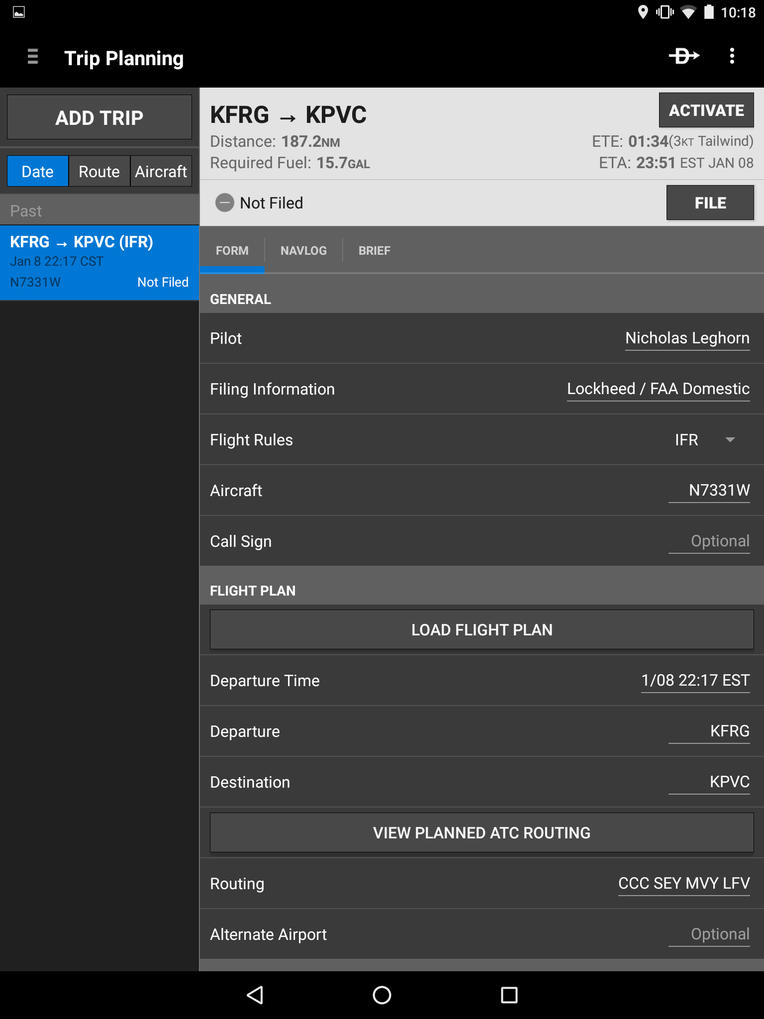
Speaking of flight plans, there’s something new here as well. The look and feel of the flight planning page has changed but the functionality has changed as well. The only option in the last version was to file via CSC DUATS, but now Garmin Pilot has integrated with Lockheed Martin to allow pilots to file directly with ATC. Flight plans now appear immediately after filing, no delays through DUATS.
Another change is the ability to file ICAO flight plans. There’s a handy system that walks you through the equipment codes for ICAO flight plans and gets you the right ones, and then you can file those flight plans through Lockheed Martin without delay. Another great change, but given that there still are no international charts available it seems like a wasted feature.

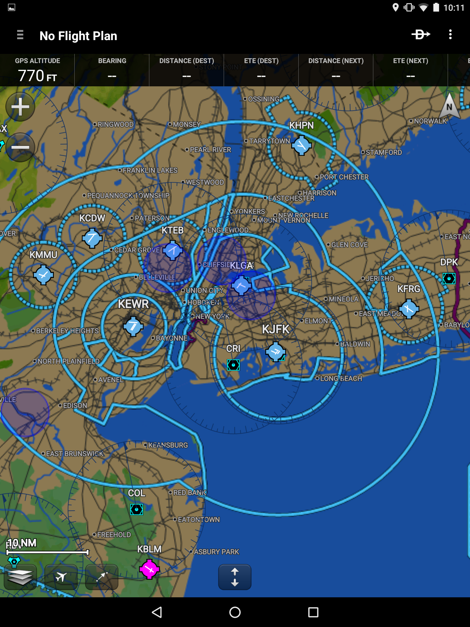
The “Direct To” button is still prominently displayed on the main map page, but the function has been improved greatly. Previously there was an “Activate” button that needed to be pressed after selecting the new destination or intermediate point on your route. This could be a little confusing, and definitely took a second to figure out. Now the UI pops up with a little box that asks if you want to activate this waypoint. Another overlay on an already crowded screen, but one that makes it much easier to navigate when you’re in the air and under pressure.
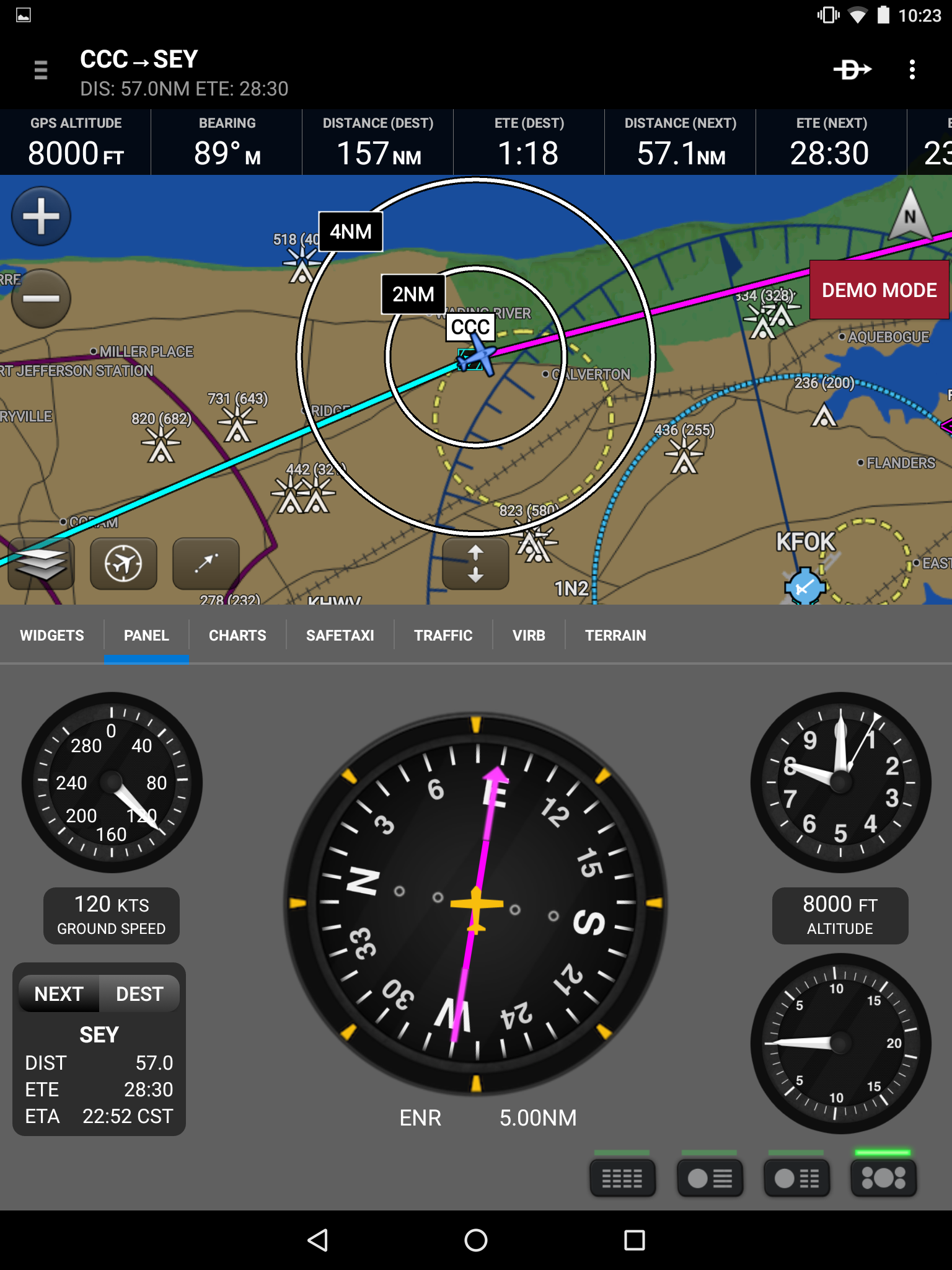
The last change isn’t really all that well fleshed out just yet, but it has the potential to be a fantastic training aid. Next to the “Direct To” button is a three dot drop down menu, and one of those items is “Demo Mode.” What this does is allow the user to select a starting location, altitude, heading, and speed, and the tablet will “fly” the course in real time. It will give you an idea of how quickly things will progress in a given situation and allow you to orient yourself to your flight, but there isn’t really a ton of functionality behind it yet. You simply pick a point and a heading, or you just say “follow the route” and the plane flies the route as depicted.
Overall these are all great changes. I love the direction they’re going, but there is still one thing missing: international charts. I’m getting ready to take a short trip into Mexico and I’d love to have all that information available on my tablet, but it isn’t a thing in Garmin Pilot just yet for Android. The iPad has all the charts, why can’t Android have them too?